Trek To Brahmatal
Posted on August 14, 2019
Day 1: Reach Lohajung
Lohajung is the base camp for the Brahmtal trek. The best way to reach here is from Kathgodam. The route, once you cross Nainital, is beautiful. You drive along mountain roads, through forests. You also get glimpses of the Garhwal mountains in the distance on a clear day.
- Altitude: 7,600 ft (2,316 m)
- Drive time: 10 hours drive from Kathgodam
Once you reach Lohajung, you find yourself face to face with the beautiful Nanda Ghunti peak. If you reach before sunset, the colours of the peak will enthral you.
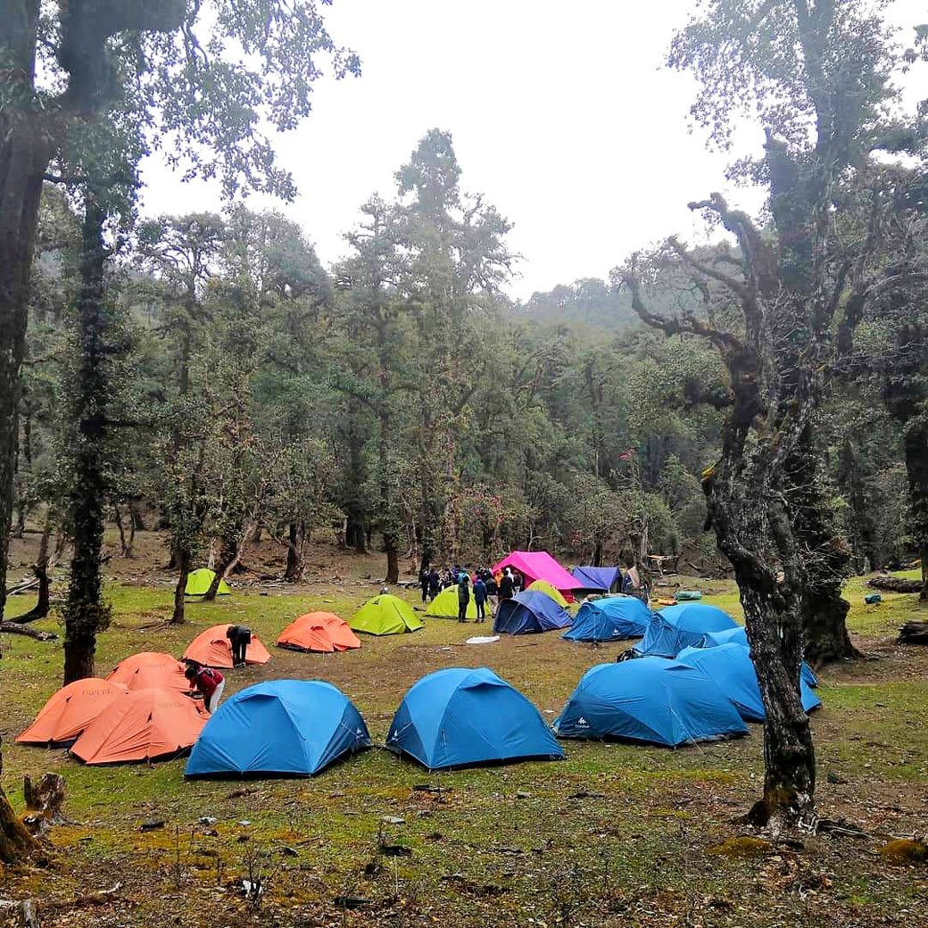
Lohajung is at the centre of 12-15 nearby villages. There are a couple of local stores where you can buy jackets, hand gloves, caps, shoes etc. if need be. However, it is advised that you carry all the required things for trek beforehand and not rely on these shops. You will have a mobile network in most parts of Lohajung.
Lohajung, as the locals say, is the place where Goddess Parvati had a war (jung) with the demon, Lohasur. Hence, the name, which translates to ‘War with Lohasur.’
Day 2: Lohajung to Bekaltal
- Altitude: 7,600 ft (2,316 m) to 9,689 ft (2,953 m)
- Time taken: 5 hours, 5.8 km
- Trek gradient: Moderate; gradually ascending through forests on well-defined trails
- Water sources: The first point where you can refill your water bottles will be around 3 hours into the trek, followed by another at the place where you stop for lunch
The trek begins from Lohajung central market (chowk). Move upwards from Bisht General Stores (compass direction 3000 NW) on the well-marked, human-made trail. Walk through the upper region of Lohajung and then through the forest trail with a few more houses. After a short trek, spot Mandoli village on your left. As you climb higher, on your left, you will be able to see the Kali Valley, where Kali and Pindari Rivers join. Follow the water pipes that supply water to Lohajung, as they lie along the trek trail. After some time, cross a small cluster of homes called Budla, on the left. Here, you will find rhododendron trees, which make this part of the trail very beautiful from February to March.
At approx 8,500 ft, you will find a 10-metre bridge (known as Link-gaad), which will help you cross the stream. After around two hours, you will reach Begum, where you can rest for some time. This place provides splendid views of Navali Bugyal (145o SSE) and Bagdi Bugyal (125o SE). After 10-15 minutes of walking from Begum, you will find another stream. From here, an hour’s walk will bring you to Gujrani stream.
From here, the trail enters thick Oak forests and keeps climbing moderately. At sections where the mountain side is to your left and valley to your right, catch the first views of Mt Trishul imposing itself in the horizon. An hour and a half through the forest climb you land at a flat with a small crater in the centre. At one end of the crater, the plateau is the valley of Deval. This place is called Khopdalia. It is actually a small dried lake. This is the campsite for Bekaltal which lies just above the campsite.
Bekaltal is a ten-minute trek up from Khopdalia. It lies surrounded by a thick cluster of Oak trees. The waters of Bekaltal is always brown. The brown water indicates a high amount of dissolved organic matter.
Typically, brown lakes are surrounded by forests or wetlands. Dense forests provide dark organic material that dissolves in lake water like a teabag. This dissolved organic material stains the water brown and shades the underwater world.
Overall, brown water lakes tend to be light-limited. The algae in these lakes survive through certain adaptations that allow them to adjust to low light levels. These lakes can also sometimes be acidic and contain few fish or other organisms.
Day 3: Bekaltal to Brahmatal
- Altitude: 9,689 ft (2,953 m) to 10,440 ft (3,182 m)
- Time taken: 5-6 hours, 7 km
- Trek gradient: Moderate. Initial steep climb for an hour brings you to a meadow where you ascend gently, followed by a gradual descent to Brahmatal.
- Water sources: None. Make sure that you fill 2 litres of water before starting the trek since this will be a long day
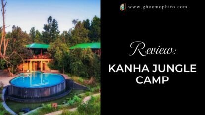
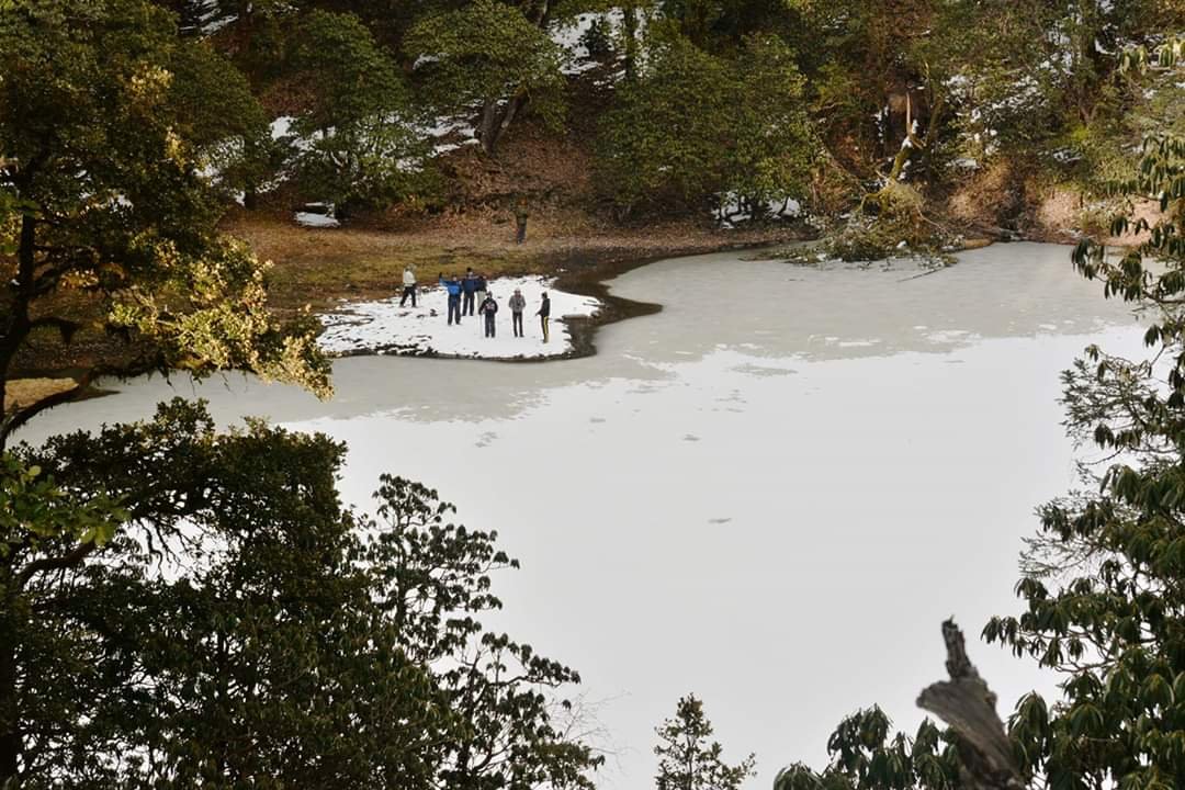
The trail starts out of the campsite and climbs steeply into the Oak and Rhododendron forest. Notice that to your left is the ridge which opens up to the valley below. Immediately to your right below is Bekaltal. As you climb on, half the trail is dominated by Rhododendron trees and somewhere midway the Oak trees take over. After about an hour, the tree line ends and you enter the meadows. Right in front of you is the spectacular panorama of Mt Trishul and Mt Nanda Ghunti with their associated ranges.
You are usually drawn to the edge of the meadows which is a ridge right on top of Lohajung your base camp. Below you is the valley from Lohajung to Wan. Right opposite where you are on the opposite mountain ridge is the famous meadows of the Roopkund trail – Aali and Bedni Bugyals.
The trail weaves along the ridge. You see the tree line sometimes below you sometimes beside you as you gain and drop height. The trees are largely Rhododendron or Oak again. Overall you gain height when you head to Jhandi Top, the highest point on the ridge. Its another vantage point for clear views of the mountain panorama. You can map the entire Roopkund trail here right from Wan to Roopkund. Spend at least twenty minutes at Jhandi Top to soak in the place. It usually gives you goosebumps to just comprehend what you are seeing in front.
As you walk along the ridge, while the right gives you big mountain views, the left opens up to sweeping valley views. You see at least 7 to 8 layers of mountain ranges one behind another. The sense of openness is unmatchable to most trekking days anywhere.
From the Jhandi top, the trail gradually descends to Brahmatal over a kilometre and half.
Once off Jhandi top, you descend below the actual ridge which takes away the mountain views. The Brahmatal campsite at 10,351 ft is 500 meters away from the lake to the left on the edge of the slope.

Day 4: Brahmatal to Khorurai via Brahmatal Top
- Altitude: 10,440 ft (3,182 m) to 12,250 ft (3,734 m) and on to 9,640 ft (2,938 m)
- Time taken: 8 hours, 7.5 km
- Trek gradient: Moderate; Moderate ascent to the ridge followed by a flat walk and then a steep descent.
- Water sources: None. Make sure you carry 2 litres of water from the camp before setting off.
The day’s trek sees you climbing back to the ridgeline you left the day before, later traversing it further before descending down the steep into the treeline. All along you will be treated to great mountain views if you have a clear sky. Anyone who treks this day will not hesitate to say that the day is the most visually fascinating day of the entire trek.
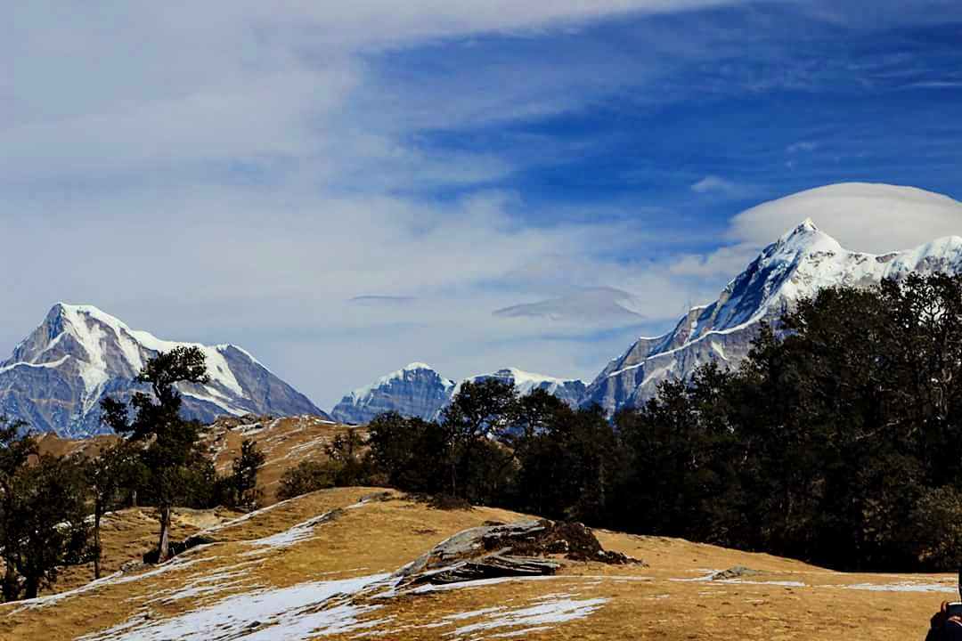
Start early by 8 A.M to give you time to catch the mountain views before the clouds come in. It takes about 10-15 minutes to trek to the Brahmatal lake your first stop on the trail. The trail till Brahmatal is a gradually ascending one through the grasslands. The Brahamatal lake sits pretty bang in the middle of the grassland in a crater. The lake glistens in deep blue colour as the morning sun rays hit its surface. The lone tree by the side of the lake reflects perfectly off its waters. Go around the lake to get a view from all angles. You will be surprised to see how different the lake looks at each angle.
From Brahmatal, take the trail to the left that climbs up to the ridge. As you move up, you see the lake set in the middle of the vast meadow. Behind you appears a wide-open valley. You can see Tharali and Gwaldam, places that you crossed on the way from Kathgodam. The first ridge climb brings you to a gently ascending stretch which then leads you to the final ridge climb. At the ridge opens up majestic views of Mt Trishul and Mt Nanda Ghunti. The view is a magnified or closer version of what you saw from Jhandi Top.
Take a moment at the pass. Have your packed lunch here. Don’t stop for long as the winds will be strong. Descent with mountains on your left and valley on your right. This part of the trail is completely new.
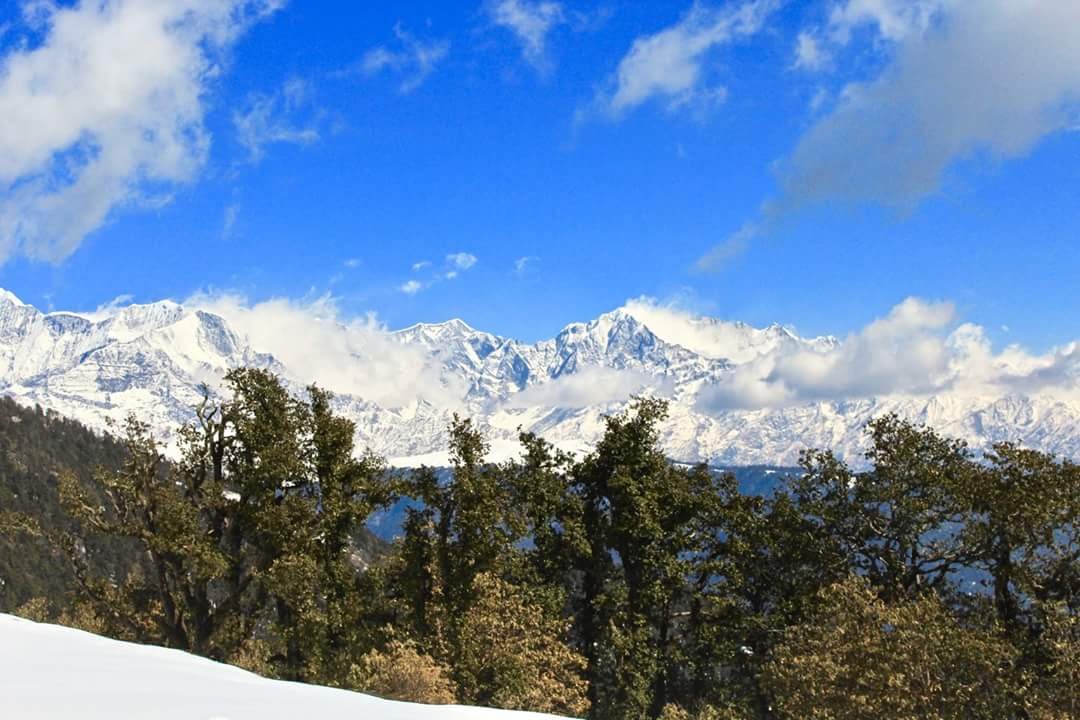
After the initial descent from the pass, the trail will ascend again through Alpine grass. Mt Trishul and Mt Nanda Ghunti accompany you on the right. As the ascent ends, you reach a platform like an area from here you get a 180-degree view of the Himalayan range. Mountains such as Chaukhambha, Mandi, Mana, Nilgiri, Neelkanth, Trishul, Nanda Ghunti, Maitoli become visible. As you continue further, a sharp narrow descent awaits you. This marks the tree line and beginning of Rhododendron and oak Forest. A descent of 1 hour will bring you to a clearing surrounded by trees on all the sides. You’ve now reached Khorurai – your campsite. Khoru in Garhwali means Brown Oak and Rai means the flat grassy area inside a forest. Take some time to rest and appreciate your surroundings.
Day 5: Khorurai to Lohajung
- Altitude: 9,640 ft (2,938 m) to 7,600 ft (2,316 m)
- Time taken: 3-4 hours, 3 km trek
- Trek gradient: Moderate.
- Water sources: Yes.
Begin the descent to Lohajung right after breakfast. The trail goes through thick oak and rhododendron forests once again. It is well made all the way and crosses 2 streams in between.
After about an hour from starting, you will reach Shephard huts. This place in the local language is also called ‘chawni’ and is used by villagers and shepherds to keep their livestock.
Continue on the man-made trail from here. This trail connects these mountain villages down to Lohajung.
Day 6: Lohajung to Kathgodam
We will drive back to Kathgodam.
- Arrival time – 6:00 – 7:00 pm
- Travelling distance- 10 hours
- Distance- 250 km